By Briann Dorin and Andy Reynolds
Vineyard blocks can vary spatially with respect to several significant variables such as soil texture and composition, vine vigor, vine physiology, yield components, and berry composition. The ability to detect this variation enables the application of precision viticulture, whereby intra-vineyard variability can be identified and corresponding responses can be made. Although it has been well established that this variation can exist, its detection is often time-consuming, with vineyard blocks spanning large areas and variation occurring over several variables. If unique zones are identified, it is possible that different wine products of varying price points could be created from these zones with minimal cost from the producer.

Before we become airborne, let’s talk about proximal sensing. GreenSeeker, CropCircle, and other ground-based (proximal sensing) technologies might allow identification of unique zones within vineyards without use of conventional aircraft or unmanned aerial vehicles (UAVs; “drones”), using continuous compilation of normalized difference vegetation index (NDVI) data from vine canopies. Data validation is required to determine relationships between proximally-sensed data and other variables of agricultural relevance, but the proximally-sensed data are relatively easy to access. Proximal sensing technologies are relatively recent introductions and their evaluation in viticulture is uncommon. For example, proximally-sensed variables correlated with vine vigor and berry color in Merlot vineyards in Greece and downy mildew levels in Italian vineyards. A linear correlation to stable isotope content in leaves (13C and 15N) provided relationships between canopy reflectance and both water status and N fertilizer uptake. There is also a project administered by Cornell University in NY called the “Efficient Vineyard Project” that has focused on the Concord grape juice industry. Despite these advances, research into proximal sensing has mainly been limited to agronomic crops and thus far, little to no viticulture-related work has been carried out in Canada.
Now, let’s talk next about UAVs. Attempts have been made with limited success to identify unique zones in vineyards by remote sensing (RS) and to associate these with vine water status, soil moisture, vine vigor, yield, and berry composition. The data that is collected must be converted to variables, e.g., NDVI or other vegetation indices (VIs). Validation of data acquired by RS is still necessary to determine whether ostensibly-unique zones are relevant from a standpoint of physiology, productivity, and berry composition. Remote sensing has been used to directly predict grape composition variables, particularly color and phenols, as well as vine water status. Overall, RS can be a useful tool for monitoring vine vigor, and for making inferences about grape composition from multispectral measurements.
Unmanned aerial vehicles have only been used for agricultural purposes relatively recently. Satellites and conventional aircraft are still used to obtain aerial images that can be used for research and agricultural purposes. There are advantages and disadvantages to each: Compared to satellites or aircraft, UAVs operate closer to the ground (90-120 m), have more flexibility in scheduling, and are not impacted by cloud cover. However, UAVs currently have a much shorter range and endurance than aircraft and satellites. UAVs produce aerial images of higher resolution and precision but depending on the size of the area flown, a greater number of images may be required to survey a given area. The increase in the number of images required to survey an area increases the cost and processing time due to increased mosaicking (stitching-together) and geocoding.
The choice of remote sensing platform really depends on the anticipated application of the acquired data. The higher the spatial resolution of the image, the better it will represent the potential intra-vineyard variability of the survey area. Accurate mapping of this variability is essential for appropriate implementation of precision viticulture practices. For this reason, UAVs are the best choice for remote sensing for precision viticulture.
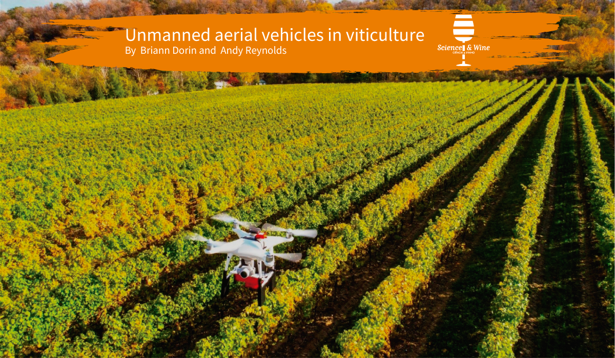
UAVs are either fixed-wing or a multi-rotor platform. Different types of platforms allow for different payloads. The payload dictates length of flight and the sensors that can be carried. UAVs utilize both hardware and software to ensure that they can successfully retrieve data. The hardware uses various components for flight navigation and accurate determination of the UAV’s relative position. A flight control board consists of a pressure sensor and accelerometers to calculate and align the UAV in relation to gravity. The navigation system, consisting of a digital compass or a magnetometer and a GPS module, allows a UAV to be programmed to fly autonomously and bring itself back to the operator. Aside from hardware required for flight and accurate positioning, the hardware for measuring canopy variables of interest—i.e. sensors—must be considered.
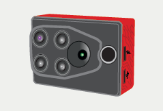
UAV platforms have a camera mount for attaching a sensor or multiple sensors. Appropriate sensors can collect useful information (leaf temperature, vine water status, canopy vigor, etc.) and the resulting maps are more detailed and useful than those compiled using conventional aircraft. The sensors (cameras) gather thermal, visible, hyperspectral and/ or multispectral images to obtain data on various canopy variables. A multi-camera array is typically used to obtain raw images needed to produce multispectral images. Depending on the number of sensors, several specific light wavelength bands can be measured. A multi-camera array is generally used to measure visible to near-infrared wavelengths, which allows for measurement of reflected light from the canopy in those spectral regions.
Raw images taken by the sensors require processing with computer software before use for research or precision agriculture. Calibration is done first, and recovers focal distance, point coordinates, and lens radial distortion of the camera. Several images are taken from different locations and orientations, which allow for calculation of the variables of the camera and the exterior orientation. Then the pictures are orthorectified, a process by which effects of tilt and terrain of the image are removed. Once the images are orthorectified and georeferenced, the images can be mosaicked together using georeferenced-based stitching software.
Attempts have been made with limited success to identify unique zones using RS and to thereafter associate these remotely-sensed regions with variables such as vine water status, soil moisture, vine vigor, yield, and berry composition. Although less laborious than manual data collection and subsequent production of a multitude of maps, use of aircraft is costly and RS in agricultural systems is often imprecise. Data that are collected must be converted to VIs, e.g., NDVI through appropriate computer software. Moreover, validation of data acquired by RS is still necessary to determine whether ostensibly-unique zones are relevant based on physiology, productivity, and berry composition. One particular challenge that we have encountered involved masking of cover crop spectral reflectance from all images to assess the vine canopy-specific NDVI and other VIs.
In viticultural applications, RS has been used in modelling vegetative growth, and to infer grape composition from those measurements. In California, remotely-sensed multispectral data were used to delineate a Chardonnay vineyard into small-lot production zones, based on weight of cane prunings (“vigor”). Vigor zones were also related to vine water status and grape composition variables. Relationships between VIs and vegetative growth were further explored, with strong, positive correlations between the VIs and vigor. Relationships established in the first season were able to predict vigor in the second season. The ability of RS to directly predict grape composition variables was explored in Australia, showing that re-sampling the image to a final pixel size approximately equal to the distance between rows, effectively combining vigor and density information into a single pixel, resulted in the strongest correlations to color and phenols. In Languedoc temporally stable relationships occurred between zones delineated based on NDVI and vegetative growth, vine water status, and yield.
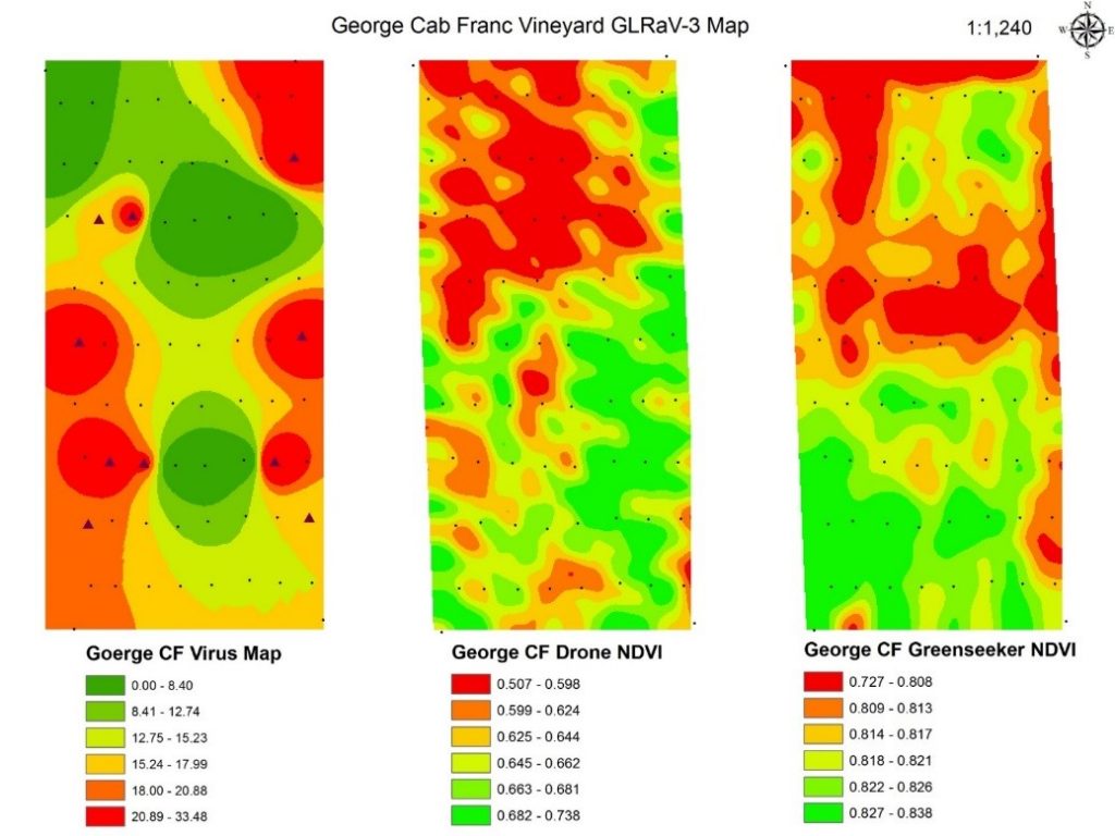
Overall, RS can be a useful tool for monitoring vineyard vegetative growth, and for making inferences about grape composition from multispectral measurements. Here in Ontario, NDVI data from aircraft-based RS were associated with numerous variables in Riesling and Pinot noir vineyards, including leaf water potential (ѱ), yield components, and berry composition. RS proved to be a good tool to determine Pinot noir anthocyanins and phenols, in addition to water status, yield and vigor. These studies were unique by studying cover-cropped vineyards, and using protocols for excluding the spectral reflectance contributed by inter-row vegetation. Aircraft-based RS has also been used elsewhere for making inferences about grape composition from multispectral measurements. However, employment of UAVs for RS in vineyards is a relatively new area of research, heretofore untested in Canada, and capable of acquiring high-resolution spatial data without high cost of aircraft. As with proximal sensing there has been little published, and most have confirmed their ability to acquire NDVI and related images. In Spain, relationships were explored between photosynthesis and chlorophyll fluorescence by hyperspectral imagery captured via UAVs. Significant relationships have been observed between photosynthesis and chlorophyll fluorescence vs. remote measurements, as well as between both chlorophyll a/b and leaf carotenoids vs. several UAV-based VIs. UAVs have likewise been utilized for assessment of vineyard water status by correlation of stem ѱ with NDVI. Further relationships have also been elucidated between several VIs (NDVI, photochemical reflectance index, renormalized difference vegetation index, red edge inflection point) vs. leaf ѱ and stomatal conductance. Nutritional stresses have been detected by UAVs; e.g., NDVI has been correlated with levels of Fe chlorosis, leaf carotenoid pigments, and grape leaf and berry anthocyanins.

It has been increasingly evident that many vineyards worldwide are infected by both grapevine leafroll-associated virus (GLRaV) as well as grapevine red blotch virus (GRBV). GLRaV is one of the most destructive and widespread diseases in all grape-growing regions globally. Yield losses from GLRaV can reach 20-40%, depending on cultivar, rootstock, soil type, vine age, and climate. Many large Ontario vineyards have attained the designation as “underperforming” by wineries, based on basic fruit maturity characteristics such as reduced total soluble solids and color. Technologies must be developed and implemented to detect zones of virus infection before entire vineyard blocks become unsuitable for quality winemaking. Discovery of evidence of correlations between both remotely- and proximally-acquired VIs such as NDVI and the titer of GLRaV and GRBV, as well as unique spectral signatures of leaves of virus-infected vines based upon spectral technology would be of significant benefit to the industry worldwide. These tools may be particularly valuable for white wine cultivars such as Riesling and Sauvignon blanc, since they are mostly asymptomatic for GLRaV and GRBV. These are ongoing investigations and could be the subject of a future article.
Briann Dorin 
Andy Reynolds 
Briann Dorin is a current PhD student at York University studying pollinator conservation in agricultural landscapes. Her research includes determining wild bee community responses to various vineyard management practices and surrounding landscape factors. Briann completed her MSc at Brock University studying the efficacy of remote sensing applications in detecting vineyard variability. She also completed an HBSc in Wildlife Biology and Conservation from the University of Guelph. Her research interests include agroecology, sustainable agriculture, and wildlife conservation. Briann DorinBriann Dorin is a current PhD student at York University studying pollinator conservation in agricultural landscapes. Her research includes determining wild bee community responses to various vineyard management practices and surrounding landscape factors. Briann completed her MSc at Brock University studying the efficacy of remote sensing applications in detecting vineyard variability. She also completed an HBSc in Wildlife Biology and Conservation from the University of Guelph. Her research interests include agroecology, sustainable agriculture, and wildlife conservation.
Andy Reynolds is a viticulture consultant in the Niagara Region in Ontario, Canada. Prior to this he was a Professor of Viticulture, Brock University, St. Catharines, ON, 1997-2020. Before this, he was a Research Scientist, viticulture & enology, Agriculture Canada Research Station, Summerland, BC (1983-1997). Andy’s education included B.Sc. (Agr.), horticulture (1978), Univ. of Guelph; M.Sc., plant breeding & genetics (1980), Univ. of Guelph; PhD (1983), Cornell Univ., horticulture and plant physiology; thesis: grapevine canopy microclimate in relation to wine quality. Andy has been conducting research in grapes and wines since MSc studies in 1978. Major research interests: use of geomatic technologies and remote sensing for studying the terroir effect; wine aroma chemistry; irrigation and water relations; cultural practices, site, and soil and their impact upon wine flavor; canopy management. Andy’s sabbatical leaves have included Washington State Univ. Pullman (1994-95), studying impact of yeast strain on flavor of Riesling, and implications of acetic acid for stuck fermentations; RH Philips Winery, Dunnigan Hills, CA (2004-05) studying new irrigation technology. Courses taught include: Grapevine Biology, Grapevine Cultural Practices, Plant Physiology, Introduction to Wines, Soil Science, Advanced Wine Flavor (graduate course). His publications: > 150 in refereed journals and symposium proceedings, as well as two books. Awards: OIV Award for Best Book in Oenology (Managing Wine Quality; 2011); Decanter Award (Grapevine Breeding Programs for the Wine Industry; 2015); ASEV/ES Outstanding Achievement Award (2010); Brock University Faculty Award for Excellence in Teaching (2009). Dr. Reynolds has been very active in American Society for Enology and Viticulture (ASEV) including Associate Editor since 1995. ASEV/ES activities: Director 1997-99, 2002-06; Chair 2000-02; Section Rep. 2006-2020. Andy is a frequent speaker at conferences internationally, or at least was, prior to COVID.
