
by Jesús Rodrigo-Comino
Dr Jesús Rodrigo-Comino (Department of Physical Geography at the Trier University) in collaboration with Prof. Dr Artemi Cerdá (Department of Physical Geography, University of Valencia) have updated a novel and cheap method for estimating soil erosion vineyards and other grafted crops. A project in which researchers from the universities of Palermo (Agata Novara), Tehran (e.g. Ali Keshavarzi), Queensland (e.g. Yeboah Gyasi-Agyei), Debrecen (László Bertalan), Extremadura (Manuel Pulido and Jesús Barrena), La Mancha (Manuel E. Lucas-Borja), Dickinson (Eric Brevik) and Wageningen (Saskia D. Keesstra) have also participated.
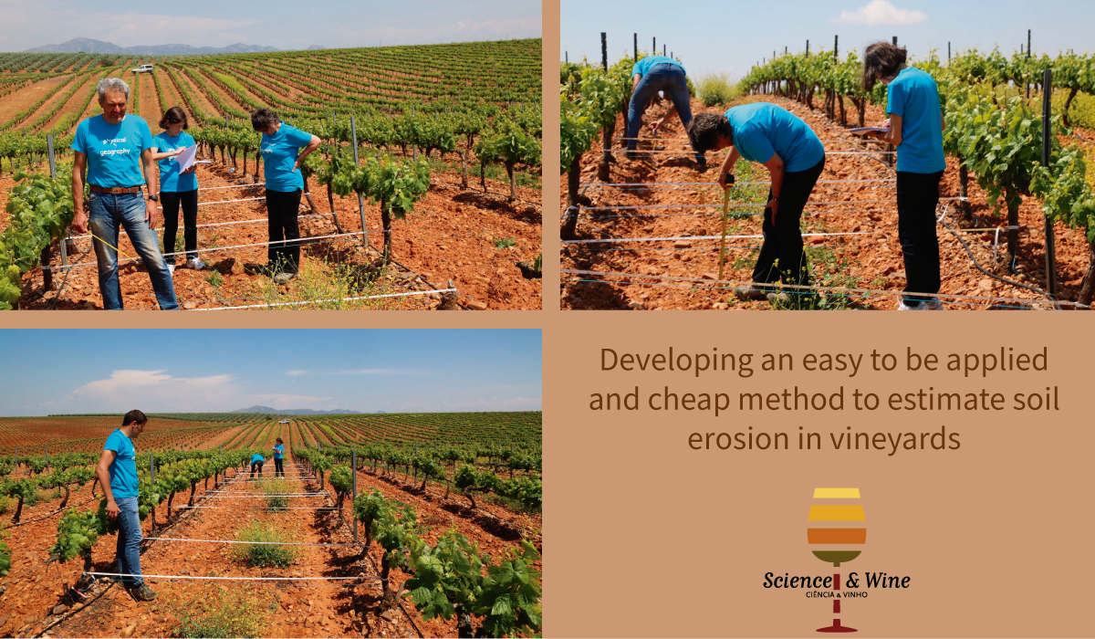
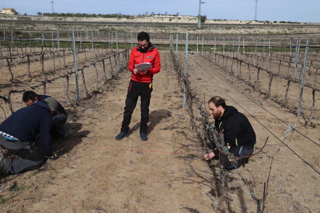
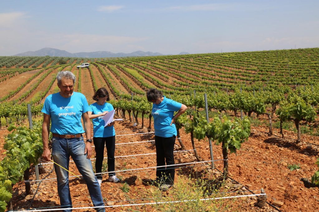
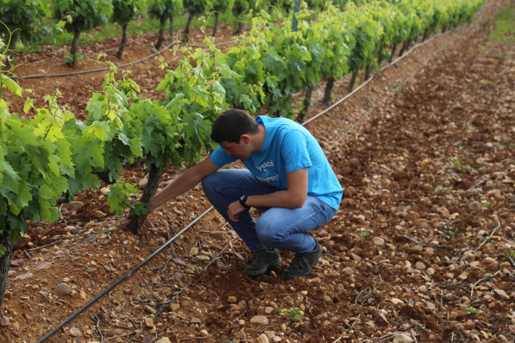
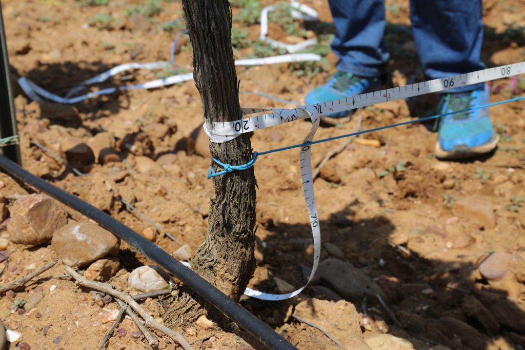
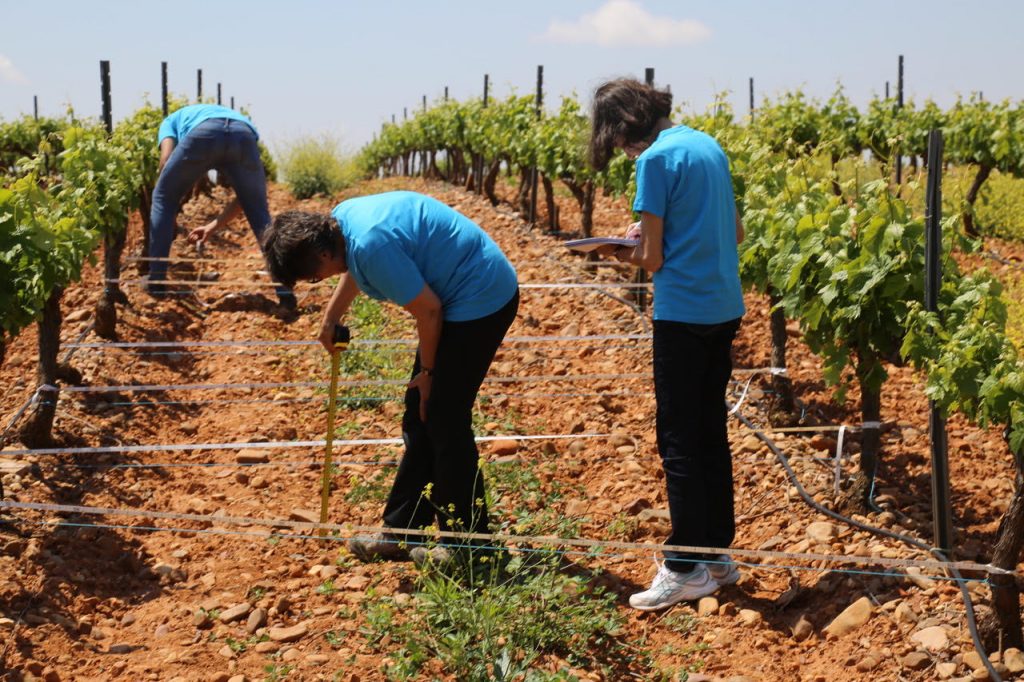
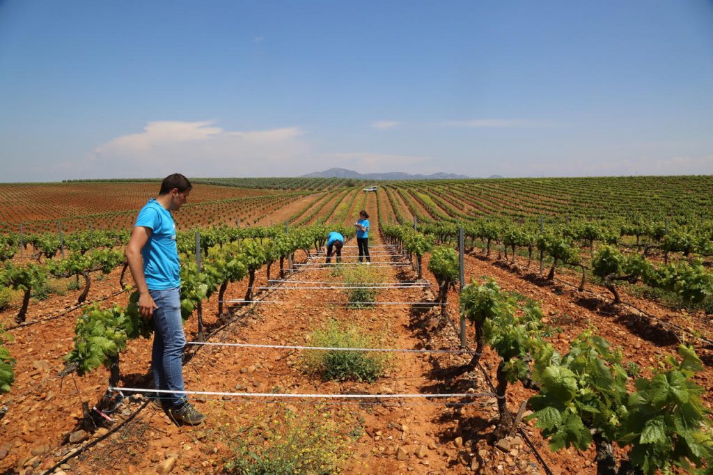
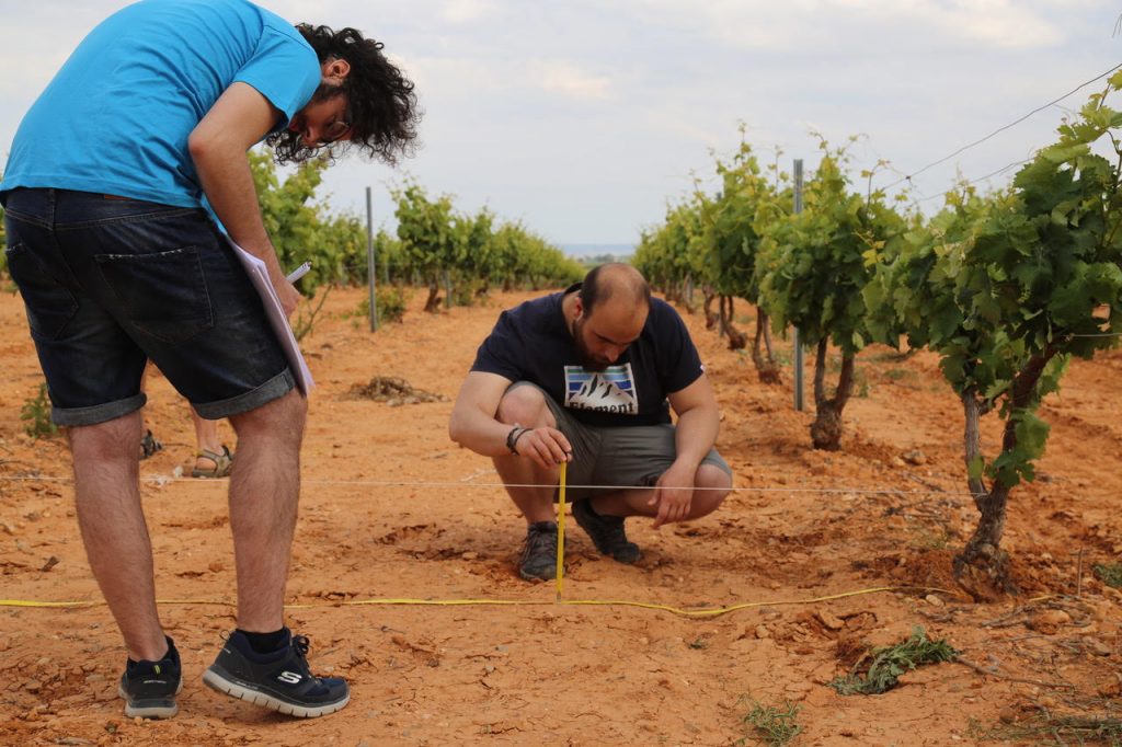
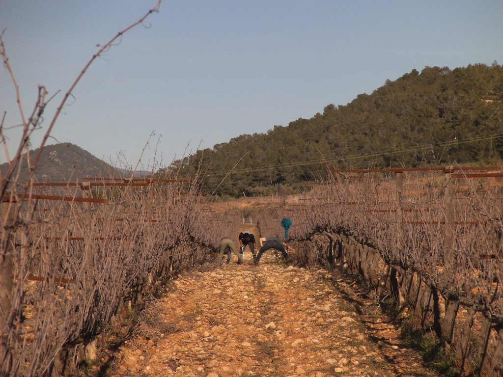
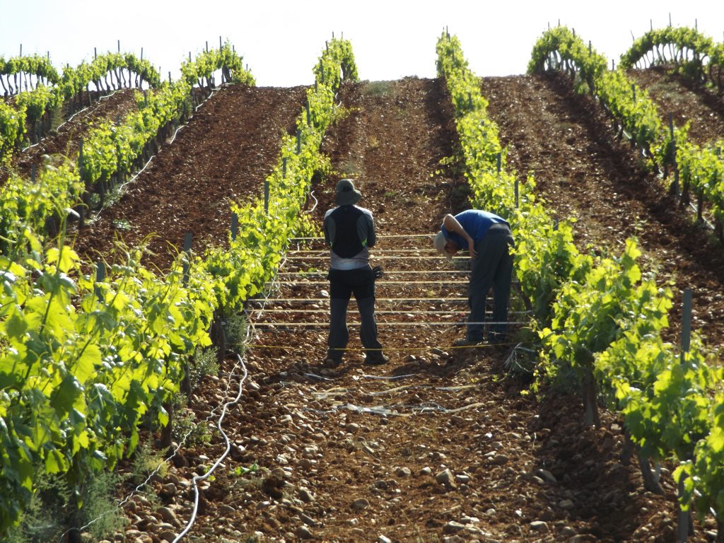
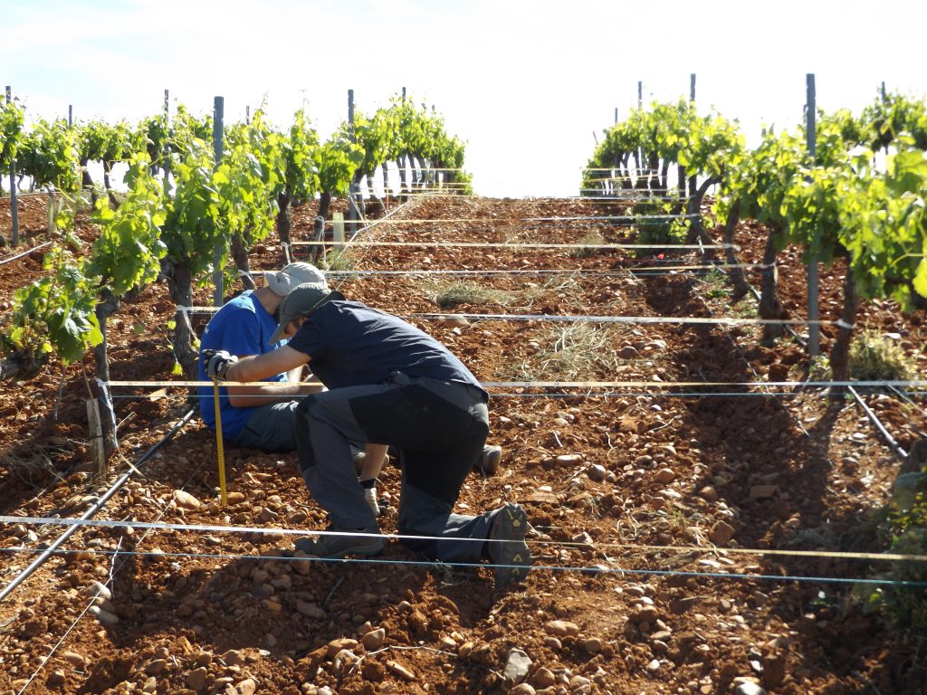
The study relies on the “improved stock unearthing method” or ISUM (Improve Stock Unearthing Method), a field erosion measurement system that considers the graft union of the vine plant or grafted crops. The stock is the part of the trunk of a vine or crop that remains attached to the root and on which the graft is planted so that the vine grows. This part does not grow vertically and does not usually change its position, so it can be detected visually if the terrain has been eroded or compacted, as verified in the first studies carried out in the French Burgundy (Amélie Quiquerez, Jerome Brenot) or Navarra (Javier Casalí and Rafael Giménez), which were taken as referents for this improvement of the method. For each measured row, we first identified the graft unions (2 vines per measurement). We then stretched meter tape between these points. Subsequently, we used a meter stick to measure the distance between the stretched meter tape and the soil surface between the vines at different locations, allowing for the measurement of the detachment and the sedimentation areas where vine stocks could be buried (positive measures) or discovered ones (negative measures). Thus, we delineated different points at each 10 cm of distance between the vines in each inter-row. From these measurements distance, we were able to: i) generate DEMs (digital elevation models); ii) increase the accuracy and precision of our final maps and soil erosion rate estimations; and, iii) detect certain erosion processes such as rills, accumulations or mass transports at the current moment.
Dr Rodrigo-Comino has worked the last years with several scientists on this topic and the recent publications can indicate how this technique has evolved, allowing understanding the erosion in the inter-row positions, connectivity processes, impact of the machinery or extreme rainfall events and effects of different management systems, parent materials or time of plantation. We demonstrated what happens with erosion in certain cases that are assumed to be true, but which had never been scientifically proven “in situ”. We want to highlight that all the field campaign also allowed making new connections between research groups and enjoying unforgettable memories with colleagues and rural inhabitants.

ISUM provides many advantages because it is not an invasive method. In addition, it is fast because many measurements can be taken on one fieldwork day and the results are also very visual for the farmers. Naturally, it also exists points to be improved such as the accuracy of the estimations and possible errors, assumptions and its application for larger scales. However, we could assess for the same time soil erosion rates in non-studied vineyards. For example, in Castilla La Mancha, where we demonstrated that one vineyard under tillage management of 10 years-old registered a total average soil surface level decrease by –1.6 cm per year and a total soil mobilization up to 17.7 Mg ha-1 year-1. In Extremadura, for the Tierra de Barros, the results showed average values of soil depletion reaching −11.5 cm in 20 years, which meant in a total area of 302.4 m2 a soil mobilisation from 70.8 to 74.0 Mg ha−1 yr−1. In Valencia, in the Celler del Roure winery, an annual total soil erosion rates of 87.7 Mg ha−1 yr−1 and 4.35 Mg ha−1 yr−1 in marly soils of 8 years-old and colluvium ones of 2 years old, respectively. This study confirmed the relevance of the parent material and time of plantation. The highest soil erosion rates use to be registered during the first years of the plantation when the soil is bare and the vines are not mature.
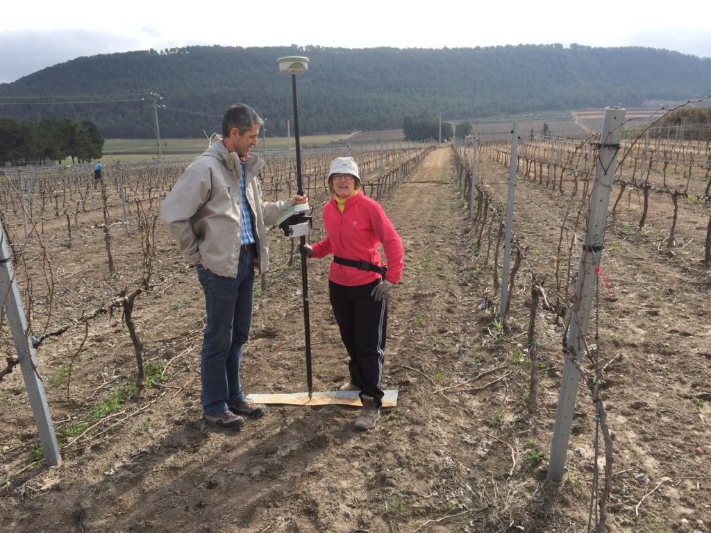
The method seeks that the farmers themselves can interpret the results and observe in which areas soil control measures must be applied. Nowadays, there is a very strong trend in the use of drones and photogrammetry to estimate soil erosion rates, although access to this complex and expensive technology and the flight licenses are very complicated for the farmers.
In the future, we claim that ISUM can be applied in countries with less economic resources and few studies on erosion in vineyards such as those in Asia, Africa or South America, where some contacts have been already done.
See more at: https://www.mdpi.com/2073-445X/9/3/93

Dr Jesús Rodrigo Comino is a PhD at the University of Málaga (Spain). He received his M.S. in land planning and GIS in 2013 in Granada and Málaga Universities. Since 2015, he has written two books related to soil geography, presented several oral conferences and posters in international meetings, and published more than 105 indexed peer-reviewed papers and 13 national articles about soil erosion, rainfall impacts and land degradation processes.
He is editor in chief of Air, Soil and Water Research (SAGE), and also works as associated editor in Hydrological Science Journal (Taylor and Francis), Journal of Mountain Science (Springer) and Hydrology (mdpi). Also, he is a reviewer for more than 115 international indexed journals. Currently, he is working on an INTERREG project about light pollution (Smart Light-HUB) at the Trier University (Germany) and COST-Action Firelinks (CA18135) as a grant holder at the University of Valencia (Spain).
References
- Barrena-González, J., RODRIGO-COMINO, J., Gyasi-Agyei, Y., Pulido, M., Cerdá, A., 2020. Applying the RUSLE and ISUM in the Tierra de Barros Vineyards (Extremadura, Spain) to Estimate Soil Mobilisation Rates. Land 9, 93. doi: 10.3390/land9030093
- RODRIGO-COMINO, J., Lucas-Borja, M., Bertalan, L., Cerdà, A., 2020. Integrating in situ measurements of an index of connectivity to assess soil erosion processes in vineyards. Hydrological Sciences Journal, in press. doi: 10.1080/02626667.2020.1711914
- RODRIGO-COMINO, J., Barrena-González, J., Pulido-Fernández, M., Cerdá, A., 2019. Estimating Non-Sustainable Soil Erosion Rates in the Tierra de Barros Vineyards (Extremadura, Spain) Using an ISUM Update. Applied Sciences 9, 3317. doi: 10.3390/app9163317
- RODRIGO-COMINO, J., Keshavarzi, A., Zeraatpisheh, M., Gyasi-Agyei, Y., Cerdà, A., 2019. Determining the best ISUM (Improved stock unearthing Method) sampling point number to model long-term soil transport and micro-topographical changes in vineyards. Comput. Electron. Agric. 159, 147–156. DOI: 10.1016/j.compag.2019.03.007
- RODRIGO-COMINO, J., Novara, A., Gyasi-Agyei, Y., Terol, E., Cerdà, A., 2018. Effects of parent material on soil erosion within Mediterranean new vineyard plantations. Engineering Geology 246, 255–261. doi: 10.1016/j.enggeo.2018.10.006
- RODRIGO-COMINO, J., Keesstra, S.D., Cerdà, A. 2018. Connectivity assessment in Mediterranean vineyards using Improved Stock Unearthed Method, LiDAR and soil erosion field surveys. Earth Surface Processes and Landforms 43 (10), 2193-2206. doi: 10.1002/ esp.4385
- RODRIGO COMINO, J., Cerdà, A. Improving Stock Unearthing Method to measure soil erosion rates in vineyards. Ecological Indicators 85, 509-517. doi: 10.1016/j.ecolind.2017.10.04